Shortly before Christmas 1847, Mobile Mayor J. W. L. Childers received a tightly rolled parcel from the United States Coastal Survey. To his delight, it proved to be an elegantly engraved chart of the entrance to Mobile Bay. Carefully unrolling it, he studied the beautifully and precisely drawn outlines of Dauphin Island, Pelican Island, Mobile Point and Cedar Point, all hemmed by gracefully curving shoal lines and crisscrossed by dotted lines representing courses and bearings. Scarcely able to conceal his excitement, Childers marveled at the chart’s wealth of useful information — depth soundings, bottom conditions (i.e. mud, sand, shell, hard, soft, sticky), navigation hazards, channel locations, tide and current notes, and precise latitude and longitude measurements for land features like Fort Morgan.
Childers wasted no time in sharing the chart with the board of aldermen and common council, who, equally pleased, passed a resolution stating their “great satisfaction.” Childers forwarded the resolution along with a short letter to Lieutenant Carlile P. Patterson, a young naval officer and skilled civil engineer then commanding a small survey schooner at the mouth of the Dog River. “We trust sir,” Childers wrote, “that the labors you are about to bestow upon Mobile Bay will fully confirm our present anticipations, and establish beyond controversy, the fact that our bay and harbor are capable of affording at least equal facilities with any other southern port to shipping of any description.”
Local officials’ gratitude stemmed from anxiety that their city was losing valuable trade to New Orleans and east coast rivals like Charleston and Savannah. To remain a viable commercial hub, Mobile needed a safe and reliable ship channel to attract better railroad connections, especially with the Midwest. Though Mobile boasted a long history of maritime commerce, getting into and out of the Bay could be difficult during the mid-nineteenth century. Inaccurate maps and a lack of channel beacons and buoys led to frustrating delays and mishaps like groundings, collisions and sinkings, costing valuable cargo and time. City fathers and business leaders considered an up-to-date, precise map of Mobile Bay’s complex bathymetry essential to their prosperity.
Happily, the United States Coastal Survey’s ongoing purpose was to alleviate problems such as these along the Atlantic, Gulf and Pacific littorals. Created in 1807 by an Act of Congress, its energetic leadership employed a range of disciplines, including astronomy, cartography, geology, hydrography, meteorology, oceanography, physics and topography, to produce the most accurate charts possible.
The survey divided the nation’s coastline into sections to better manage the task. Mobile fell within Section VIII, which extended from Bon Secour Bay to Vermilion Bay, Louisiana. Different parties of specialists worked in this section at any given time, conducting observations and assembling data. The longitude men built a small shelter in Bienville Square from which to pursue their observations “of the inferior transits of circumpolar stars” (there was less much light pollution then!); two triangulation parties laid down baselines and measured angles with various target points to accurately calculate distance; two topographical teams sketched the coastlines and measured elevations above sea level; and the hydrographic contingent investigated the actual waters and seafloor. As the chart delivered to Mayor Childers indicated, the survey had already been working the area for some time. Their next project involved mapping the Bay’s middle and upper reaches, heavily traversed by everything from fishing vessels, tugs, scows and steamboats to sea-going schooners and brigs.
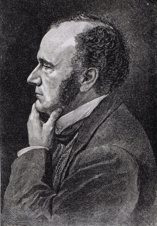
Photo courtesy Wikicommons
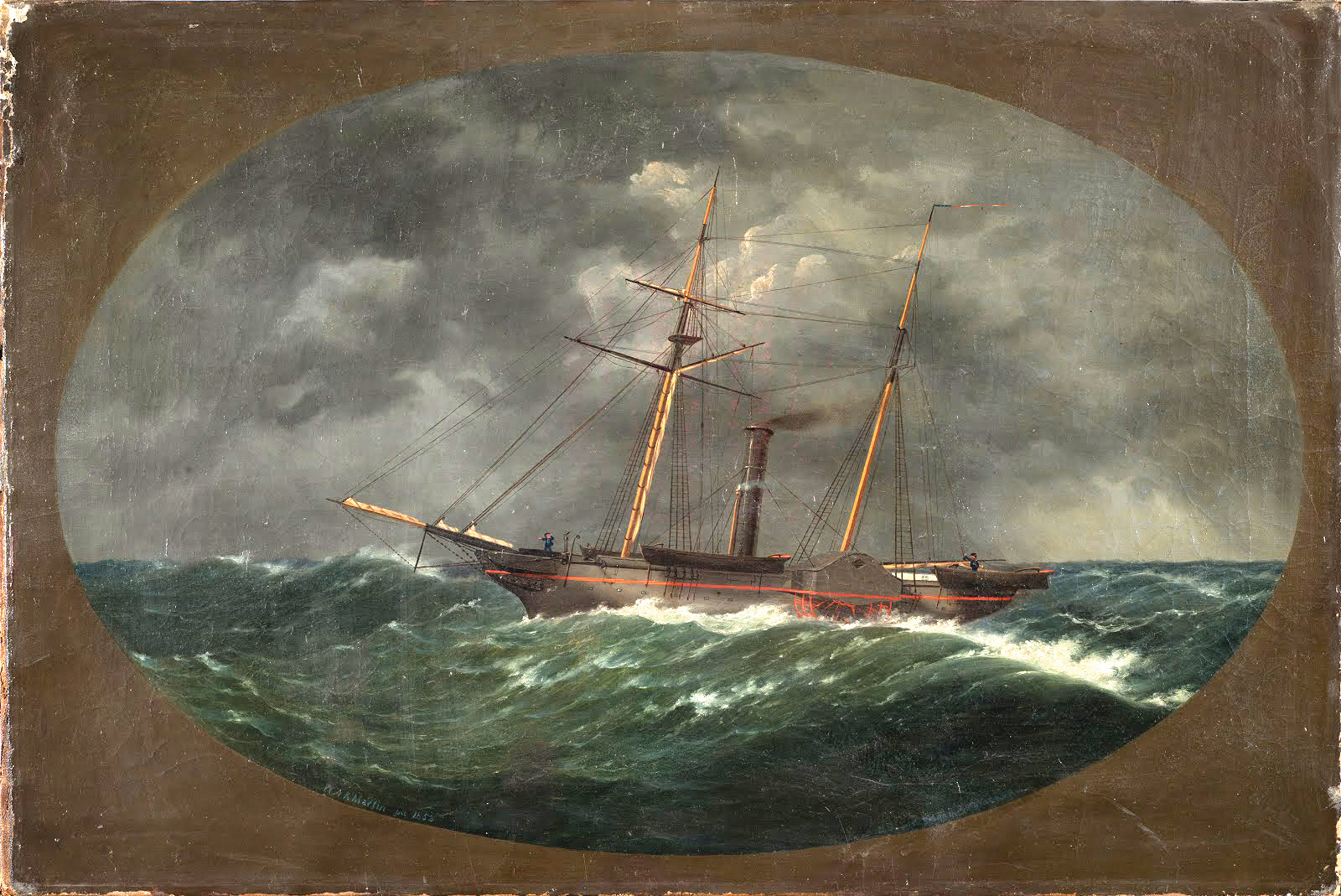
Upon receiving their resolution, Lt. Patterson, who led the hydrographical party, thanked Mobile’s officials for their “cheering appreciation of our duties.” By January of 1849, he enjoyed the use of a brand new 133-foot, 358-ton, iron-hulled sidewheel steamer named Robert J. Walker for his work. She featured a tall funnel, a pair of raked masts and a red-trimmed elegance of line calculated to gladden a mariner’s heart. Patterson called her “the finest iron vessel ever built in this country.”
During the next six months, Patterson kept the ship in the deeper channels and dispatched smaller boats to take soundings to the very shorelines. He and his crew surveyed 145 square miles of Mobile Bay (out of 413 overall), obtained 71,745 depth soundings and carefully tabulated winds, currents and tides. The work was not without risk. On May 21, one of the team’s small boats capsized in the Bay, and Assistant Surgeon Silas Holmes, whom his mates described as an “acerbic wit,” drowned. Patterson mourned the loss but kept at his task. What stood out to him by late summer was the pressing need for more and better buoys and navigational markers. In a memo dated August 29, he declared that “during the past year $40,000 worth of property has been lost on or near the bar, and $20,000 and upwards has been paid for salvage, and this, in the opinion of all, for want of good marks to clear the dangers.” Patterson also calculated the Survey’s overall savings at 40% in using a steam vessel like Robert J. Walker, which could maneuver wherever it wanted at any time, as opposed to sail-dependent vessels.
Patterson requested a transfer to the West Coast the following season, and the Mobile hydrographical work passed to other equally capable officers like James Alden (who would later fight for the Union at the Battle of Mobile Bay) and B. F. Sands. All the hydrographic data then went to cartographers, who combined it with the results of the other parties’ work to draw an accurate map of the Bay. They delivered their map to the survey’s engraving division, where a specially trained artist used an acid tipped stylus to incise it onto a copper plate. The copper plate then went to the printers, who employed a lithographic press to run off sheets for public distribution. The resulting 38-inch-by-29-inch color Mobile Bay chart appeared in 1856 to universal admiration. It depicted the Bay from Blakeley to the Gulf and Little Point Clear to Point aux Pins. The ship channel was clearly delineated, and detailed sailing instructions along with wind and tide information appeared neatly printed on the right margin.
As with the chart of the Bay mouth a few years earlier, the survey sent complimentary copies to local officials, ship captains, shipping agents and wharf owners. While long since superseded by revisions and new maps, the 1856 United States Coastal Survey chart remains one of the most beautiful and meticulous ever produced of our magnificent Mobile Bay.


